
Flooding Emergencies
NWS: Hazardous Weather Outlook: Experimental Graphical Hazardous Weather Outlook
NWS: Advanced Hydrologic Prediction Service, Springfield NJ: National Weather Service Advanced Hydrologic Prediction Service
USGS: Rahway River at Kenilworth, NJ Telemetry: Rahway River at Kenilworth NJ - USGS Water Data for the Nation
FLASH FLOODING MAPS: The following locations have been observed to experience flash flooding, separate and apart from River Flooding, and residents should use a common-sense approach when determining which areas to avoid driving or parking during flash flooding: Cranford Flash Flood Map
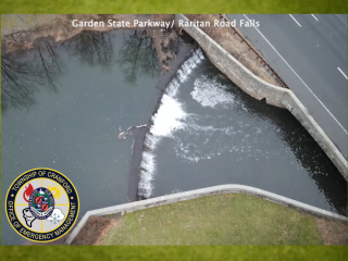
FLOOD GATES AND PORTABLE PUMPS:
General Preparedness: Cranford OEM will routinely monitor weather conditions and forecast guidance as part of normal steady-state operations. If excessive rainfall or flooding conditions are forecast, Cranford OEM will assess the need to open the river gates as an emergency protective measure. OEM will also assess the need to deploy the portable pumps to Balmiere Parkway. This assessment should be in conjunction with the Cranford Public Works and Engineering Departments.
Pump Deployment Guidelines:
The Cranford Department of Public Works (DPW) maintains, operates, and deploys the pumping equipment used at this location. The Cranford Office of Emergency Management (OEM) will provide situational awareness and decision support to the DPW in the determination of pump deployment
Pumping equipment is necessary to provide supplemental drainage to the Balmiere Parkway neighborhood when the river level is generally higher than the roadway level. To determine river level in conjunction with the Roadway, the Staff Gauge can be used. When the staff gauge reads 63.5’ the river is roughly level with the storm discharges and the roadway and flooding may begin in the road if rain is still falling. As a general guideline, if the river reaches 62.5’ and precipitation is still falling or the Springfield telemetry levels are still rising, it is advisable to deploy the pumps as a protective measure.
Pre-Storm Deployment: Monitoring of weather forecasts and expected rainfall can be used to determine if the pumps should be deployed pre-storm. This is always the preferable solution as staff can deploy these in better working conditions during normal hours. Precipitation forecasts should be assessed in conjunction with recent rainfall and hydrologic projections to determine if river rises are likely. Generally, rainfall amounts exceeding 3” in normal conditions, or potentially less during times of ground saturation, have resulted in the river level reaching or approaching the 63.5 level.
River Gates Guidelines:
Best Practices: Cranford OEM will incorporate multiple data and guidance sources in assessing whether it is advisable to open the river gates. These should include;
1. National Weather Service (NWS) hydrologic forecast discussions and official forecasts.
2. Headwater Guidance and Daily Briefing products issued by the NWS Middle Atlantic River Forecast Center (MARFC)
3. Excessive Rainfall Forecasts issued by the Weather Prediction Center (WPC)
4. Tropical Forecasts issued by the National Hurricane Center (NHC)
5. Actual river levels, available from the Springfield and Kenilworth upstream gauges via the NWS.
6. NWS Flood, Flash Flood, and Areal Flood Advisory Products (if issued for the event)
7. Past experience and discussion between Township professionals.